Press & media enquiries
You can find all Chilterns National Landscape news items, position statements and press releases on this page, along with downloadable logos, images, facts and figures about the area, and information on filming permits. For further quotes or interviews, contact details are listed below.
About the Chilterns National Landscape
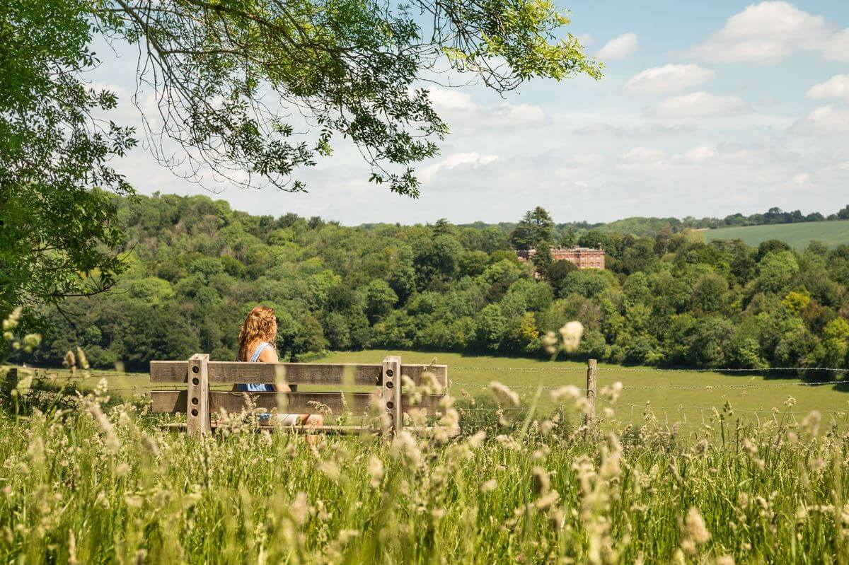
The Chilterns National Landscape covers 833 square kilometres across Buckinghamshire, Oxfordshire, Hertfordshire and Bedfordshire. The many rare species and habitats, rolling chalk hills, magnificent beechwoods and wildflower-rich hills are just some of the special features of the Chilterns which are enjoyed by local people and visitors alike.
There are few landscapes which could claim to have as much recreational opportunity as the Chilterns, the extensive network of well-signposted footpaths and bridleways make it easy to explore the area by foot or bicycle. There are also lots of countryside sites where you can relax, enjoy the scenery, have a picnic, or take a walk. With 1.6 million people living within 8km and 10 million people living within an hour, the Chilterns is one of the most accessible protected landscapes in Europe.

Latest press releases and publications
An update on our management plan
We are legally required to produce a new or updated management plan to replace the existing one by the end of March 2025.
Calling all artists: new national arts programme
We are seeking writers and artists to take part in Nature Calling – a new national arts programme.
Revitalising the Hamble Brook
For the first time in more than 140 years, the Hamble Brook has a new wetland site.
Map, video and images
The assets below can be downloaded for use in press and media and any publications relating to the Chilterns National Landscape. Please ensure that you credit the copyrights mentioned in the image title. Do contact us if you’d like a higher resolution version of any of the images or alternative map views.

Aerial footage of the Chilterns National Landscape
Click below to view aerial footage of the Chilterns countryside on YouTube (credit: Hedley Thorne).
Image gallery
Filming in the Chilterns
From gorgeous chalk grassland meadows to ancient beech woodlands, historic pubs to stately homes, quintessential English villages to bustling town centres; the Chilterns has some fantastic film locations and is home to four of the largest film studios in the UK – Pinewood Studios in Buckinghamshire, and Elstree Studios, Warner Bros. Studios Leavesden, and Sky Studios Elstree in Hertfordshire.
The Chilterns National Landscape doesn’t own any land, so you will need to obtain filming permission from the landowners of your chosen location. Some local authorities have dedicated film offices to co-ordinate production needs. For more information on filming, see below:
- Buckinghamshire Film Office
- Hertfordshire Film Office
- Filming in Oxfordshire
- Filming in Bedfordshire
- Filming in England


Outstanding Chilterns Magazine
Outstanding Chilterns is our annual magazine. Read conservation and wildlife stories, interviews, project updates, volunteering opportunities, inclusive countryside news, and keep up with Chilterns experiences and events.
Read it online below or contact us if you’d like a hard copy.
Using our Chilterns National Landscape logos
You can download the Chilterns National Landscape logo below.
Logo use guidance:
- The Chilterns National Landscape logo represents the area, and can be used on the cover of any publication whose contents relates to the National Landscape and issues within it.
- Please use the logo for publications and presentations about partnership work with us, e.g. on publicity for your event in the Chilterns Walking Festival.
- The logo should be placed at the bottom of the page in a white strip so that it stands out clearly, and there should be no text printed beneath. On interpretation boards it may be more convenient to use the logo near the top, underneath the main title.
- Contact our communications team if you require any further guidance about using the logo, or require a logo in a different style, like monochrome or with a transparent background.


Map of the Chilterns National Landscape
Click below to download a simple map of the Chilterns National Landscape boundary, which also highlights major towns nearby.
Please contact us if you have a specific map requirement.
Download
Chilterns AONB map

Our management plan
The Chilterns National Landscape management plan 2019-2024 contains a comprehensive summary of the key issues facing the National Landscape and the management policies and actions needed to conserve this special place. The involvement of a wide range of organisations is essential in achieving the plan’s aims over the next five years.
The Chilterns National Landscape in facts and figures
Here’s a snapshot of the Chilterns National Landscape in numbers and facts.
Population and tourism
- 80,000 people live in the Chilterns National Landscape.
- 50,000 people live within 5 miles.
- 10 million people live within an hour’s drive.
- Leisure visits to the Chilterns National Landscape generate around £500 million per annum to the local economy.

Distances and heights
- The Chilterns National Landscape covers 839 sq km (324 sq miles) across four counties (c84,000 ha).
- The centre of the Chilterns is only 35 miles from Trafalgar Square, London.
- The highest point in the Chilterns is 267 metres above sea level (876 feet) at Haddington Hill, near Wendover in Bucks.
- The National Landscape straddles 13 local authorities (three county councils, two unitary authorities, and eight district and borough councils).
- The Chilterns National Landscape has 2,000 km (1,200 miles) of rights of way.
- Two National Trails (Thames Path and The Ridgeway).
- The Chilterns is the only National Landscape accessible via the London Underground.

Nature and wildlife
The Chilterns has:
- About 700 hectares of chalk grassland with up to 40 different species per square metre.
- 64 Sites of Special Scientific Interest wholly or partly within the National Landscape.
- 21% woodland cover, three times the national average for England.
- 60% of all woodland in the Chilterns is ancient woodland.
- Nine rare chalk streams.
- England’s largest population of red kites.

History
- The Chilterns National Landscape has been protected as an area of outstanding natural beauty (AONB) since 1965.
- The chalk in the Chilterns used to be at the bottom of the ocean – it was formed between 70 and 95 million years ago from the shells of tiny sea creatures.
- The name “Chiltern” comes from the Cilternsæte, a tribe that occupied the area in the early Anglo-Saxon period.
- There are 22 known hillforts across the Chilterns.
- Britain’s oldest route, the Icknield Way, runs along the northern edge of the Chilterns.

Cholesbury Hillfort
Famous people
- Famous Chilterns residents past and present include William Penn (the founder of Pennsylvania), Roald Dahl (author), and George Harrison and Ozzy Osbourne (musicians).
- The Aston Martin car was named after the hill climb at Aston Hill, near Wendover.
- John Milton completed Paradise Lost in his cottage in Chalfont St Giles.

Roald Dahl Museum
What makes the Chilterns special?
The Chilterns’ special qualities are considered so significant, nationally and internationally, that they require protection.
- Read more in our attached PDF.
- Plus download our full facts and figures infographic below.

Email newsletter
For Chilterns National Landscape project news, conservation updates, boundary review news, events, job vacancies and more, sign up to our email newsletter below.
Further press and media enquiries
For any further press and media enquiries please contact our communications team.
Tel: 01844 355521
Email: communications@chilterns.org.uk.

About us
Featured walks

Keep in touch!
Plan your trip to the Chilterns!


