

Lilley and Warden Hill loop: full route
By Nigel Seabrooke, Chiltern Society
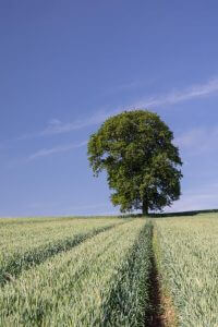
A 4.8 mile stile-free walk starting from the historic village of Lilley and walking largely gently through farmland and chalk downland to the summit of Warden Hill. You will be rewarded with far reaching views in all directions. Warden Hill is home to many wild flowers and butterflies.
This is one of a series of social-distancing friendly walks, avoiding the most crowded countryside car parks and footpaths. It avoids narrow footpaths wherever possible, but please be aware that there are some short sections of narrow footpath where this is unavoidable. Vegetation also narrows the paths at this time of year, especially where there is a back-log of footpath clearance due to Covid-19. This is a joint venture between the Chilterns Conservation Board and Chiltern Society and all the walks have been submitted by volunteers. Please note that pubs, cafes, visitor attractions and facilities (including public toilets) might not be open as usual and some will require pre-booking. Please check before setting out. Please remember to follow the Countryside Code.
Details of route
-
![Starting point icon]() Starting point West Street, Lilley LU2 8LN.
Starting point West Street, Lilley LU2 8LN. -
![Duration icon]() Duration
Duration -
![Distance Icon]() Distance 4.8 miles
Distance 4.8 miles -
![OS Ref Icon]() OS Ref TL 118264
OS Ref TL 118264
The steps you need to take
Route
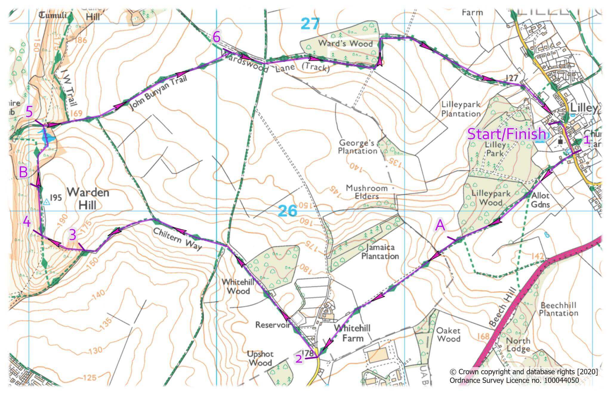
Walk to the grass triangle by the road junction and continue past the church and turn right into Cassel Memorial Hall car park.
Waypoint 1
Follow the Chiltern Way past the Hall and follow the footpath to enter a field. Continue along the right-hand edge, pass through a small copse and straight across the next field. Bear slightly left at a gate to cross a third field to a lane.
Waypoint 2
Turn right onto lane for 40m and fork left onto wide part concrete track. Pass the metal barrier to a 4 way junction of bridleways. Continue straight on with hedgerow on left. Where the hedgerow ends, bear left onto wide grassy bridleway between fields. Follow it as it drops down and sweeps right up to a kissing gate.
Waypoint 3
The route now leaves the Chiltern Way by continuing straight ahead up the steep hill on an open path. Follow the fence on the right to pass through a gate at top of the hill. The route now rejoins the Chiltern Way with views opening up on all sides.
Waypoint 4
Continue in same direction to the left of the fence and walk past a triangulation point. Drop down a few steps, follow the path around the shoulder of hill and descend to a path junction. Ignore the path on the left and continue straight down to pass through gate onto a track.
Waypoint 5
Turn right up past the Nature Reserve and continue straight on to join the John Bunyan Trail to reach a T-junction of tracks.
Waypoint 6
Turn right onto Wardswood Lane (wide track) and follow past the wood on the left and continue to where it turns left onto private land. Here, continue straight ahead on a narrower track that later becomes a metalled lane. Follow the lane to return to the start point.
Points of interest
Lilley
There are historic cottages, many with John Sowerby’s lion crest. He owned the village in late 18th century. St Peter’s Church dating from the 12th century and restored in the late 19th century.
A North Chiltern Trail / Chiltern Way
The Chiltern Way is a 135 mile circular trail around the Chilterns AONB, designed by the Chiltern Society. In 2014 the society added the North Chiltern Trail, a 43 mile circuit of the best scenery at the north-eastern corner of the Chilterns.
B Warden Hill
There are far reaching views in all directions including chalk downland, rolling farmland and Luton in the valley below.
Download
 PDF map and route description
Map only
Download GPX data for this route
Visitor information
Just a few miles from Lilley, Hitchin town centre has cobbled streets full of historic interest radiating out from the parish church. There are some well established independent shops amongst the high street names and the traditional open market is the largest in the Home Counties. The Hitchin Craft and Farmers Market takes place on the last Saturday of the month.